-
satellite_demos
satellite_demos
|
|
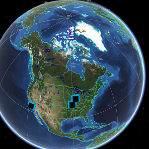
This directory contains various examples and demonstrations of AFSIM’s
satellite capability and satellite interaction with other platforms
and the overall environment.
Following are the top-level files to be loaded and run in the AFSIM Wizard.
1st_comsat_demo.txt
This example uses the amateur radio satellite AO-51 (Echo) to simulate a
standard communications satellite. Transmitters on the ground use it as
a relay to communicate between themselves.
The transmit/receive parameters were retrieved from the AO-51 link budget
on the website ‘www.amsat.org’. The debug output was verified against the
results of the calculator.
Note that the satellite will be available to both ground stations only during
the time from about 420 sec to 980 sec and in some cases the S/N may be
too low.
Message traffic is generated by having a sensor produce tracks. The
sensor will ‘detect’ the satellite and then attempt to send the track
to the other ground stations.
2nd_gps_demo.txt
This example demonstrates a GPS constellation and its availability
to be seen from a specified location on the earth.
3rd_background_sats.txt
This example places over 600 distinct satellites in orbit.
The TLE’s were retrieved from http://celestrak.com using the Perl script
“download_tle.pl” This script may be re-run as needed to update the TLE
definitions to the current time.
4th_constellation_demo.txt
This example demonstrates how to easily create a notional satellite
constellation with only a basic understanding of orbital elements.
5th_iridium_flares_demo.txt
Iridium Flares are very localized events that look like flares
or shooting stars: they become very bright and then fade away
over a period of about ten seconds. Some flares are 100x brighter than
the brightest star. They are caused by specular reflection by the sun
from the Iridium Satellites solar panels and main communications antennae,
which look like shiny flat plates that act like mirrors.
This demo computes flare locations for the entire Iridium satellite
constellation. Lines are drawn from the satellites to the approximate flare
location on the ground. A platform is created and moved across the ground
to visualize the flare’s ground track.
If you want to use this as a tool to see the flares, change the lat/lon/alt
defined in script_variables, below, to your location; then set the
GMT_Offset to the correct offset for your time zone. Either use the
“start_time_now” setting to get a current report, or set the start_date and
start_time to the desired observing date and time (keep in mind that the time
is UT, not local time).
Update the iridium platforms list by running the “download_tle.pl”
Perl script, which will automatically update all major TLE lists from the
Celestrack website, including the Iridium satellite TLEs
When you run this demo, a custom file gives a report of nearby flares
and local az/el locations of the satellites. You can also try tethering to
the “center” platform in Mystic and pan around to visualize
the satellite’s location relative to your viewing location.
6th_Hohmann_leo_orbit_transfer_demo.txt
This example demonstrates a Hohmann transfer to a satellite in LEO.
There are two burns in a Hohmann transfer, the first one is critically
timed so the apogee of the transfer orbit coincides with the
final orbit. The second burn is performed at apogee, at the
time of rendezvous. After both burns, the two satellites are in
the same orbit with the same “phase” (anomaly).
GPS_denied_demo.txt
In this demo, a fighter bomber fires two missiles at a ground radar site.
When the radar site begins to track the incoming missiles, it begins to
jam the GPS signal going to the missiles. The GPS on-board the missiles
is then denied and they revert back to ins errors,
which ultimately leads to their missing the target.
iridium_demo.txt
This example demonstrates how a person in India can call a person in Paraguay
at the same time someone in Oklahoma calls a person in Chad. Both calls
take the path with fewest hops between satellites. These paths update
as the satellites move in and out of range.
aerobraking_demo.txt
This example demonstrates the use of the WSF_INTEGRATING_SPACE_MOVER
to set up dynamics that include atmospheric drag. This scenario includes
one platform on an orbit starting near the Moon, and plunging into the
atmosphere of the Earth. The drag resulting from the operation slows the
platform down, and over a number of passes through the atmosphere, the
orbit apoapsis is significantly reduced.