Satellite Tether View - Mystic
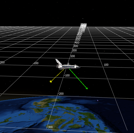
The satellite tether view is a tethered view that is only available on satellites. The display is graphically optimized for views from space and provides tools useful in this domain. Data is displayed in the RIC coordinate frame of the selected entity. In the RIC frame:
R - is the axis defined by a vector from the center of the earth to the platform’s location
C - is the axis defined by the angular momentum vector perpendicular to R
I - is the cross product of C and R
The view can be found by right clicking a platform with a spatial domain set to space and selecting Satellite Tether.
Context Menu
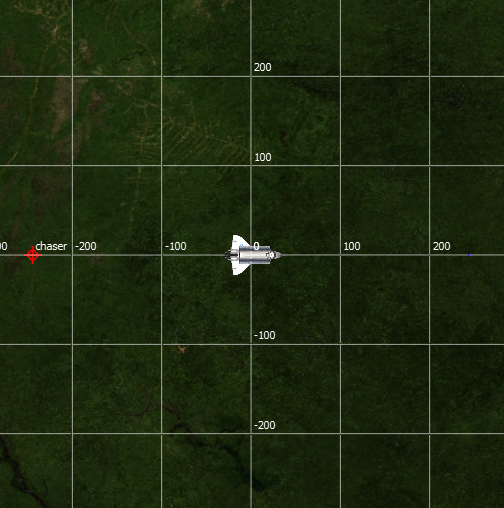
Show IC Grid - Swaps to a In-Track / Cross-Track grid and camera-view
Show IR Grid - Swaps to a In-Track / Radial grid and camera-view
Show RC Grid - Swaps to a Radial / Cross-Track grid and camera-view
No Grid - Disables the grid
Cartesian Grid - Sets grids to draw in Cartesian coordinates
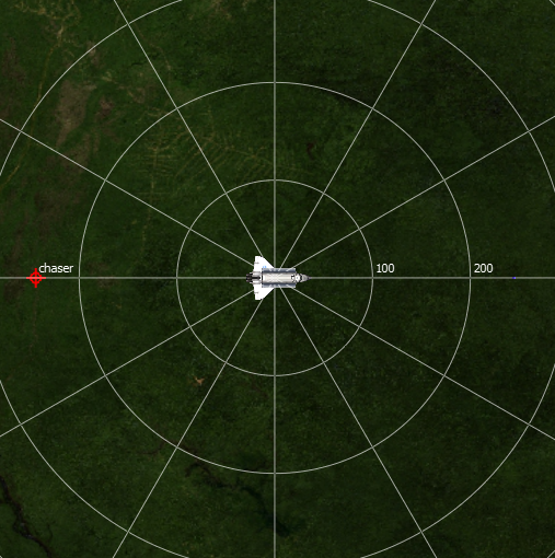
Radial Grid - Sets grids to draw in radial coordinates
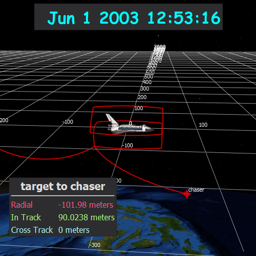
Add Track - Adds a tracked space-domain platform to the display. Tracked entities will show an icon and trace-lines in the original platform’s RIC frame. If the tracked entity’s orbit color has been set, the icon and trace-line will be set to that color. Multiple platforms may be tracked.
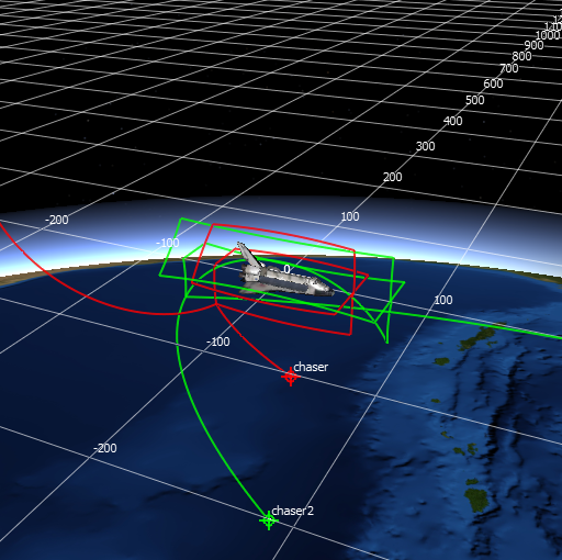
Tether - Once a platform is tracked, the tether can be changed between the tracks and the original platform.
Clear Tracks - This option will clear out all tracked platforms.
Vectors - Vectors may be added to the original platform. Vectors may point to other platforms, the sun, the moon, the earth, the platform’s (ECEF) coordinate frame, and the platform’s (ECEF) velocity vector.
Dragged Data Display - Data displays may be dragged off of the platform details, relative geometry, or time displays to add data display overlays.
Preferences
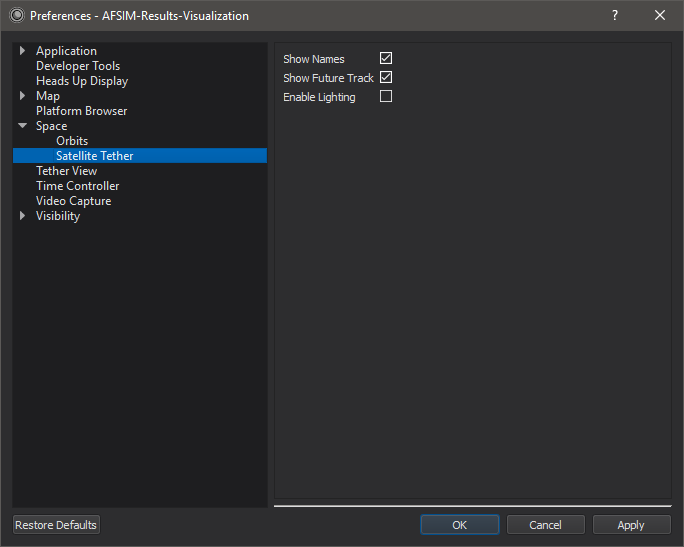
Show Names - When this option is enabled, tracked platforms will display their names.
Show Future Tracks - When this option is enabled track-lines will draw their future data translucently. When disabled, future data will be hidden.
Enable Lighting - Enable the lighting of the terrain and models.
Platform History
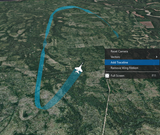
Right clicking on the tether view provides access to platform history options.
Add/Remove Traceline - Displays the platforms trace-line history.
Add/Remove Wing Ribbon - Displays the platform’s wing-ribbon history.
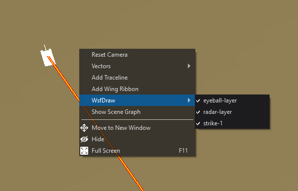
WsfDraw
If there are visible draw layers, right clicking on the tether view provides access to a WsfDraw menu that controls the visibility of the different draw layers that have been specified. By default, all draw layers will be turned off.