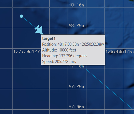
Map Hover Information - Mystic
The Map Hover Info plugin is responsible for displaying tooltips when using the cursor to mouse over platforms and tracks in the Map Display.
Map Hover Info Preferences
The Map Hover Info Preferences provides an interface for customizing the data that is displayed by the map hover tooltip.
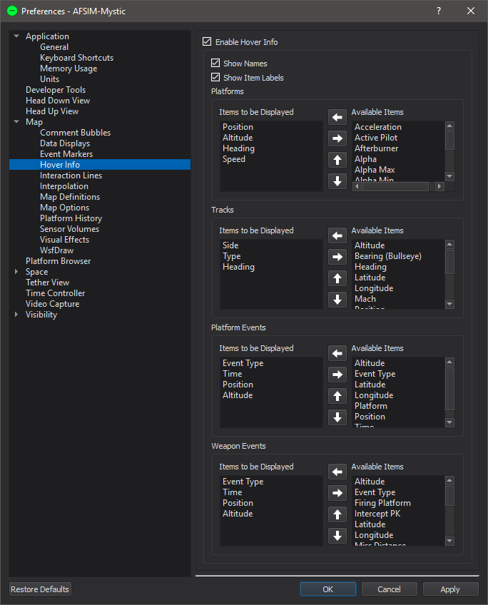
Enable Hover Info - Turns on/off the Hover Info display entirely.
Show Names - The Hover Info display will list the name of the platform or track.
Show Item Labels - Each data field displayed, will have the name of the data field shown in front of the value.
The Platform and Track Hover Info sections control which data will be shown when the cursor is moved over a platform or track.
To modify the data shown, select a label
The Left/Right Arrows move items in and out of the Items To Be Displayed category.
The Up/Down Arrows control the order the information is displayed in the tooltip.
Note
Some data values are shown in reference to a Bullseye. These items are denoted with the “(Bullseye)” text. If no Bullseye is specified, the display will be the string “no bullseye”.
Note
When Mach is enabled for platforms, it will only appear for air and space platforms.